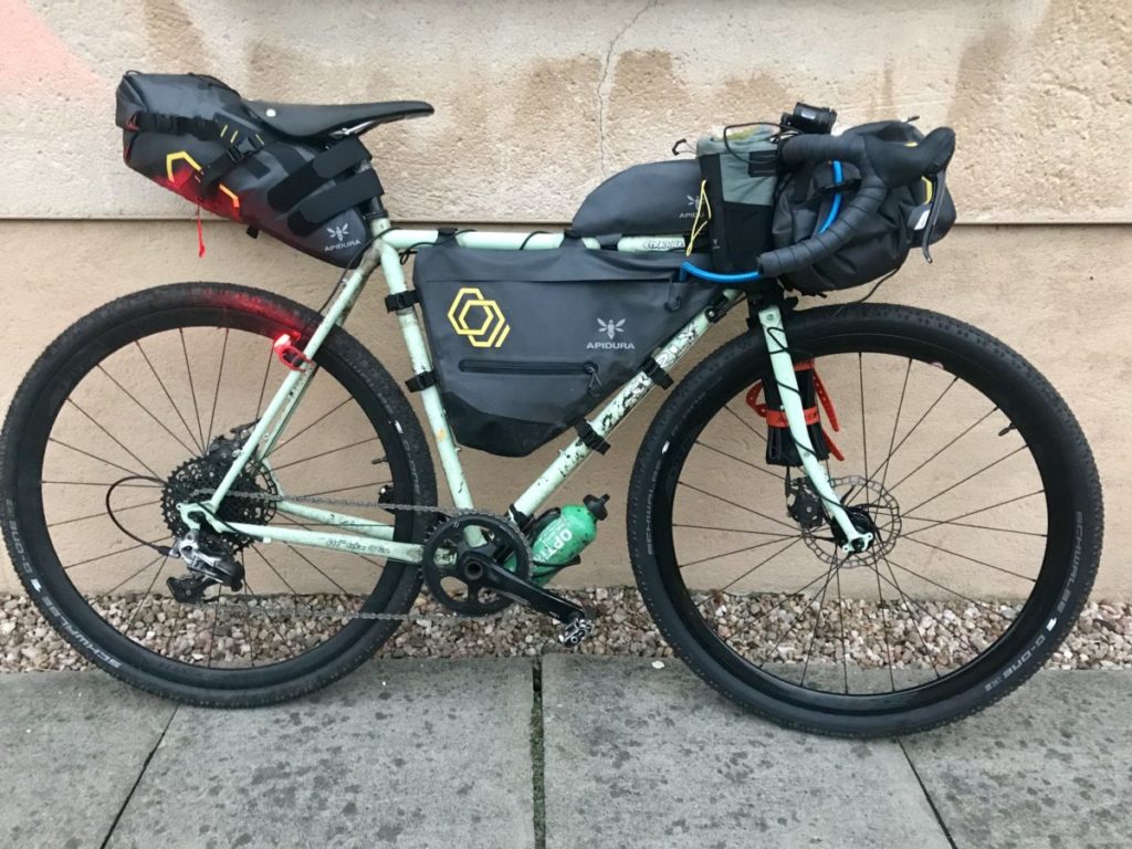
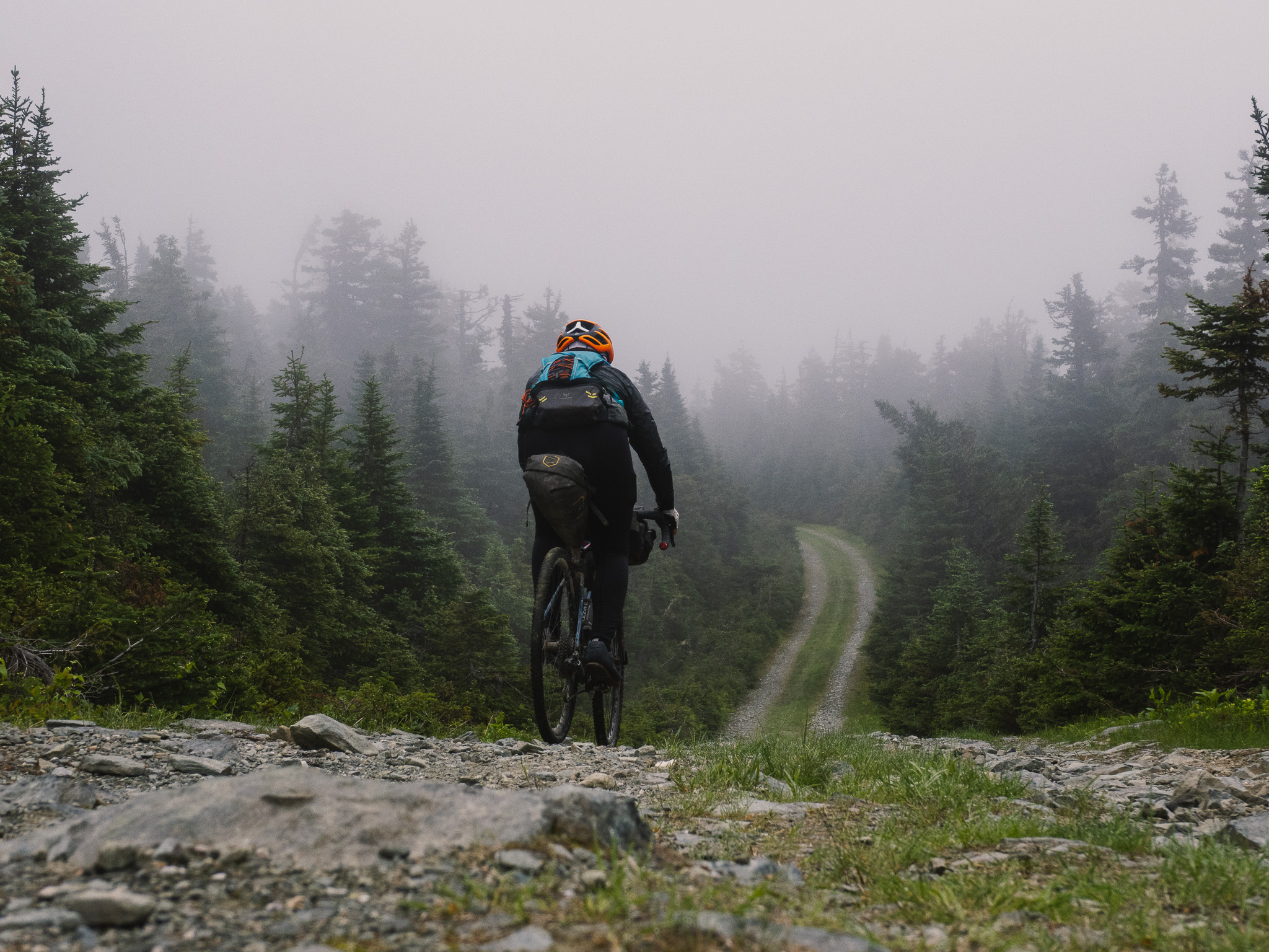
It feels that I have reached the boundary of what is possible on this trip when I push my bike up Mount Logan. The track marks the first time I have to get off my Argon18 Dark Matter gravel bike, as both the gearing ratio and the loose surface make it impossible to ride up here. While the light is slowly fading, the path gets even steeper the closer I get to the top, but the views are worth the extra effort. Rising 1,150 m above sea level, the mountain is the highest point in the Bas-Saint-Laurent region. From the top I can spot two small huts in the far distance. Judging by the map on my phone, one of them is La Chouette, the refuge I have booked for the night.
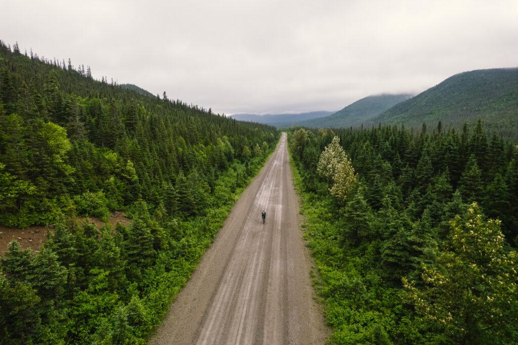
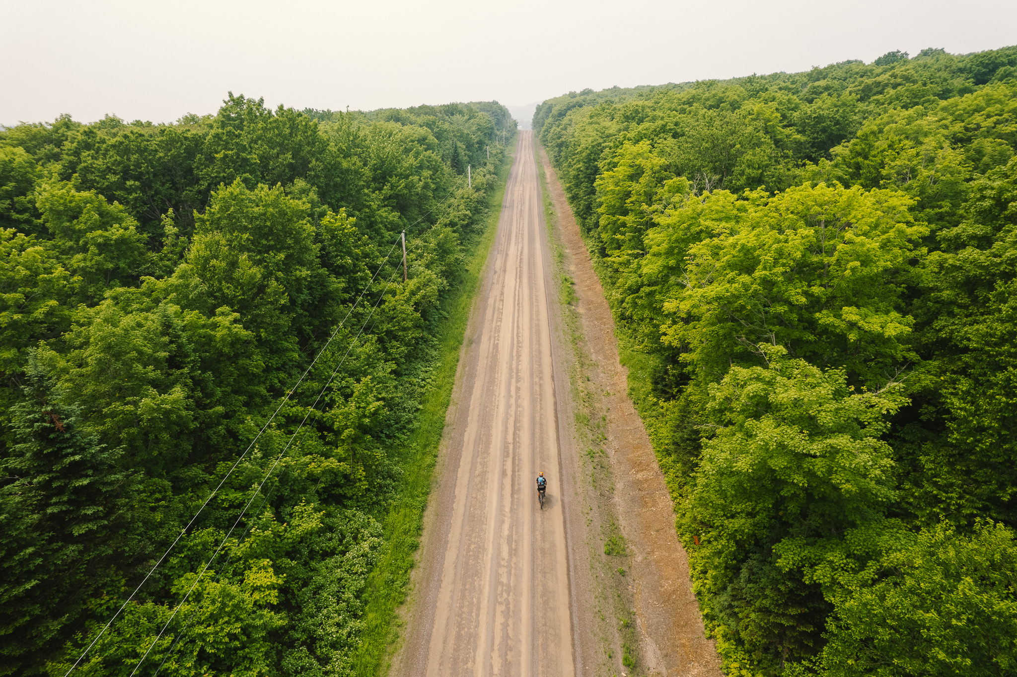
The ride up here was long and strenuous. Mostly on wide gravel roads used for logging, I started the ‘La Transgaspésie’ in Amqui in the morning of the fifth day of my 10-day bikepacking trip on Canada’s east coast. The route, devised by Jérémie Bourdages-Duclot and published on bikepacking.com, forms part of my gravel adventure in Québec. La Transgaspésie takes its name from Gaspésie, the French name for the Gaspé Peninsula. Mostly on gravel roads, the route traverses the Gaspé Peninsula on 446 kilometres, with a spicy 7,958 m of climbing thrown in. Along the south shore of the St. Lawrence River in the north, the peninsula extends from the Matapedia Valley in the west into the Gulf of St. Lawrence in the east. The Baie des Chaleurs and the Restigouche River form the southern boundary.
The name Gaspé likely originates from the Mi’gmaq word Gespeg – meaning ‘land’s end’. Gaspé claims the title of ‘Cradle of French America’. When French explorer Jacques Cartier came to Canada on 6 July 1534 he met the Mi’gmaq, the local tribe, in the Baie des Chaleurs, but didn’t set foot on the shore. On 14 July, during a big storm, he came for shelter in the Bay of Gaspé and met the Iroquois de Stadaconé (known as Québec today). On 24 July Cartier claimed possession of the area by planting a wooden cross with the king’s coat of arms and the sentence Vive le Roi de France (‘Long live the King of France’).
My journey to get to Amqui is a route I mapped with the help of Komoot and local advice (available here). At times I follow the Route Verte, the longest network of cycling trails in North America, crisscrossing some of Québec’s most scenic regions and connecting the province to neighbouring bikeways in Ontario, New Brunswick and the United States.
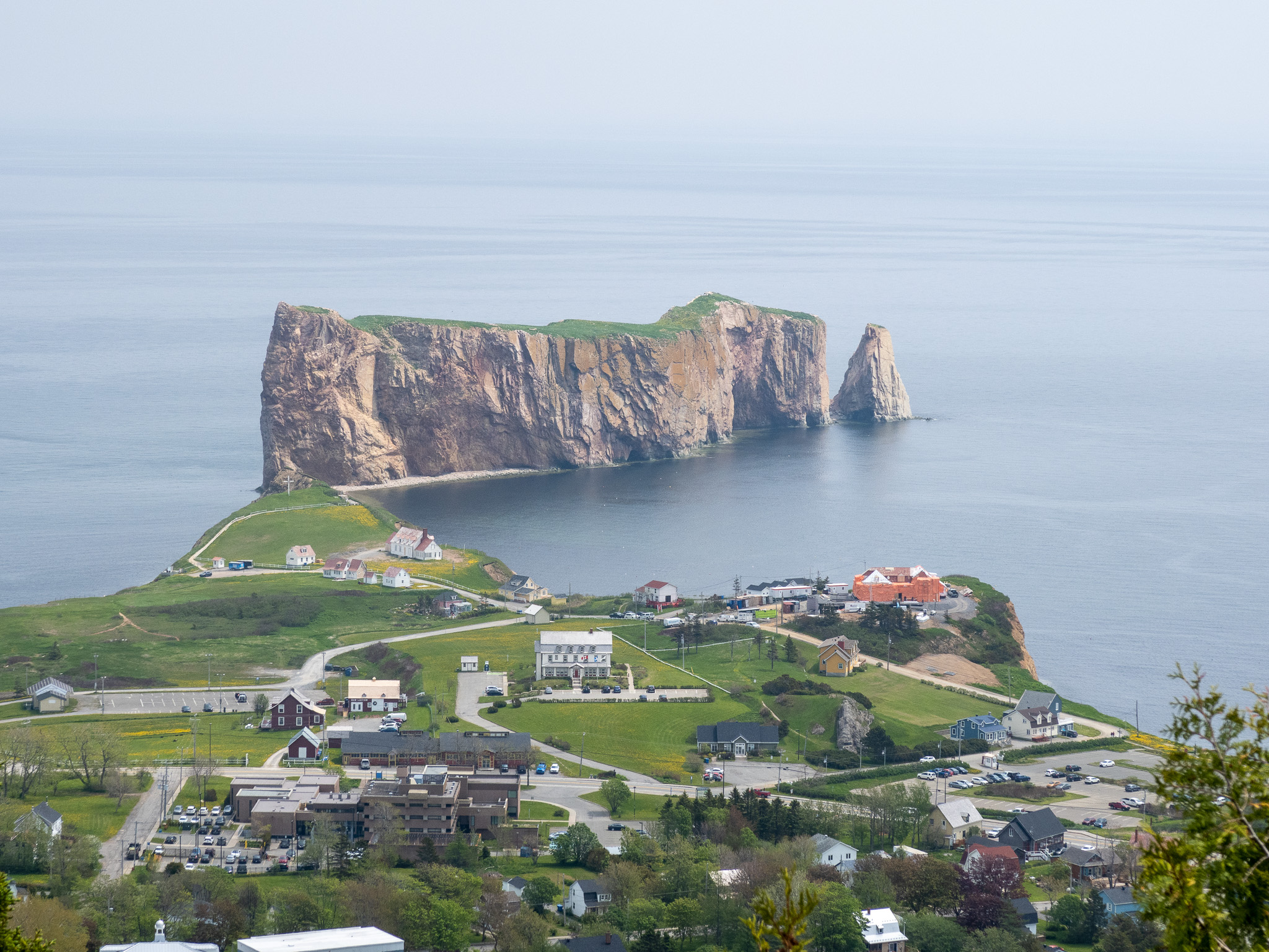
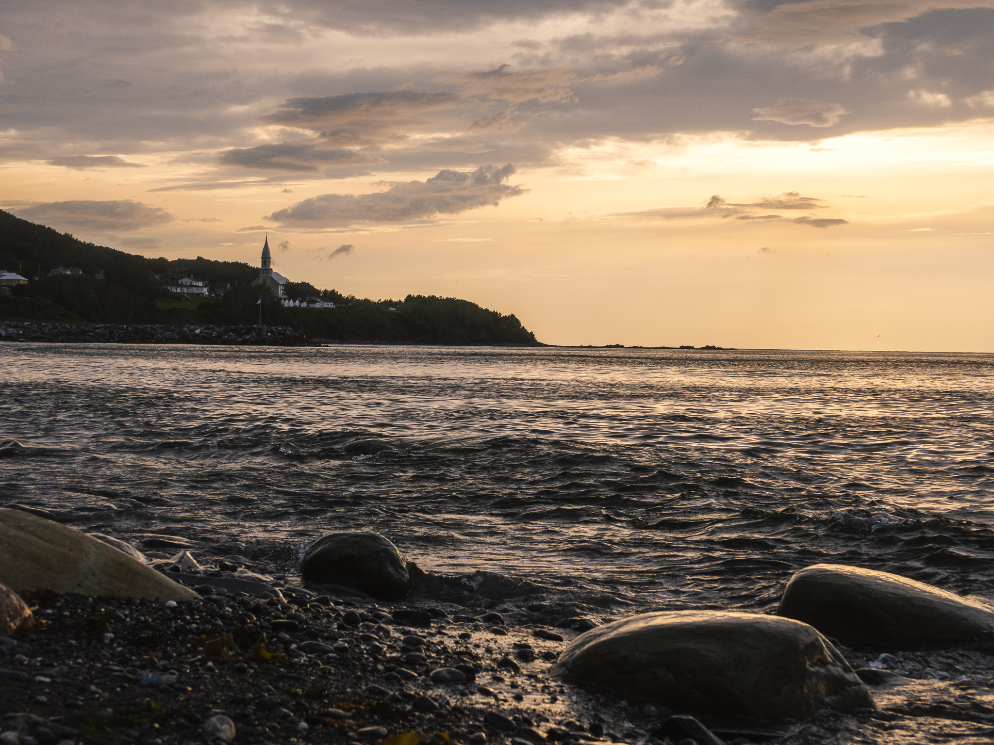
Starting in Forillon National Park I cycled mainly along the coast to Pointe-à-la-Croix, before taking a very short detour into New Brunswick and heading inland following the Matapedia River to Amqui. Notable features on the coast were the barachois, coastal lagoons partially or totally separated from the ocean by a sand or shingle bar and Percé Rock, one of the world’s largest natural arches located in water and the world’s most accessible northern gannet colony, visible from far afield and a major attraction in the Gaspésie.
There was no shortage of great cafes here, and my route passed fabulous microbreweries like Pit Caribou in the fishing harbour of Anse-à-Beaufils and Le Naufrageur in Carleton-sur-Mer. Other highlights were the Parc national de Miguasha near Nouvelle, an important fossil site included on the prestigious UNESCO World Heritage List, and Paspébiac, Québec’s first cod fishing port and once home to a massive fishing industry.
My ride so far was a great mix of coastal scenery, wide gravel roads through seemingly endless forests, and small towns with great places to eat. But I had also felt the impact of the forest fires that raged in Québec’s north first hand. A yellow cloud of smoke was blown from the north to the Gaspé Peninsula for most of the trip so far. The further inland I went, the more humid the air got, and the dust from the roads coated my sweaty arms and legs with a thick brown layer. While the forecast on my phone was for clear skies and sunny days, the yellow smoke made it impossible to see any blue skies, and gave the sun a deep red glow.
I had experienced similar conditions in South East Asia on my round the world trip, where native forests were deliberately burned to make space for palm oil plantations. For Canada, such an extensive amount of wildfires is unusual. To put it into context, as of 27 June 8.8 million cumulative hectares were burned in 2023, while the 10-year average across Canada is 805,196 hectares – a ten-fold increase.
For days I had been hoping to spot a moose or a bear, but I had not been lucky so far. My original plan was to camp at spots further inland in the wilderness, but the hot air and mosquitos made me opt for much more pleasant campsites on the coast instead, where the air would cool down nicely in the evenings and mornings with the sea breeze.
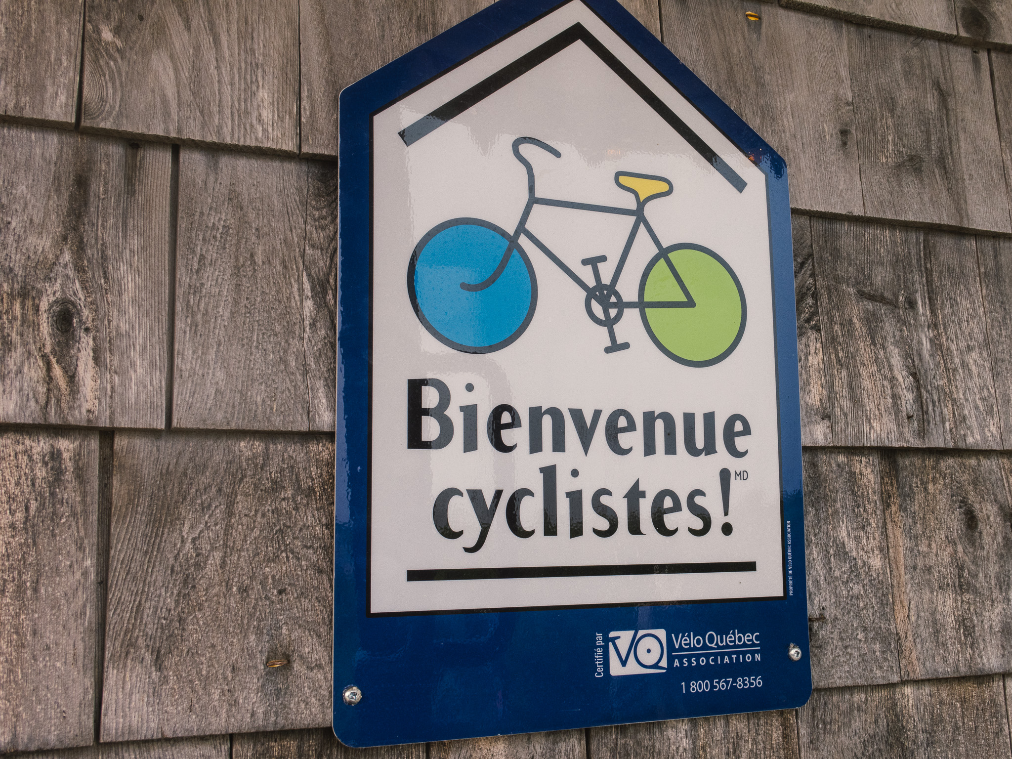
While I spent almost £30 for a pitch on the first night, from the second night onwards I made good use of Velo Québec’s Bienvenue cyclistes! At participating campsites, of which there are a good few to choose from, this offers cyclists a guaranteed camping space, even without a reservation, at a very competitive price. As I carried my own stove, I could pitch my tent, then do a quick shopping ride and enjoy my evening meal with a view to the sea, a good local beer and a different cheese as dessert each night.
While I enjoyed the route I mapped to get to Amqui, I was also looking forward to following Jérémie’s route, which seemed remote and very adventurous. At the heart of the route is the Parc de la Gaspésie (Gaspésie National Park), created in April 1937 to permanently protect the flora and fauna of the Gaspésie. The season for riding bikes here is rather short, as snow on the north face of the mountains in the park is still present in early June. By the middle of September the moose hunting season starts, so the best window for bikepacking is from late June to early September.
I know that my best chances to spot a moose are in one of the national parks, and I am very happy when I finally get lucky. She is standing right at the entrance of the Parc de la Gaspésie, almost like someone had placed her there for a postcard. The boundary of the park marks the start of the most remote section of my trip, taking me through mostly untouched landscapes. Blocked off by a big steel chain, this part of the La Transgaspésie is off limits for any motorised vehicles.
When I descend from Mount Logan at La Chouette, the two other people occupying the hut are rather surprised to see me arriving in the dark. Similar to the backcountry huts in New Zealand or Norway the hut is basic, but provides everything for a comfortable night – a mattress on a bunk bed, a fireplace, a nice kitchen table to eat and a compost toilet outside.
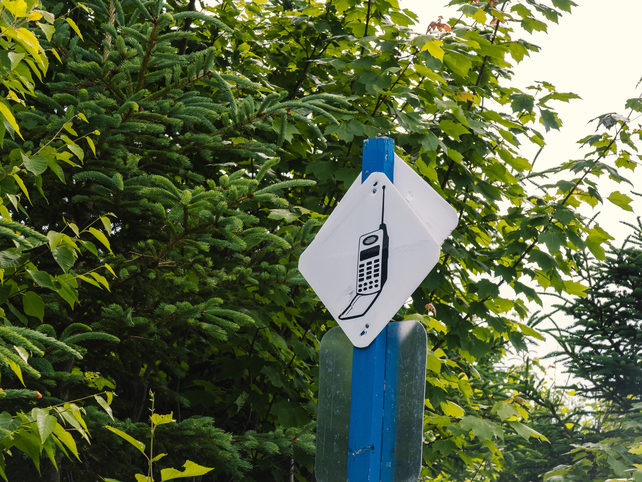
From here I follow La Transgaspésie through the mind blowing landscape of the Chic-Choc Mountains. A mixture of extensive native forests, small lakes and mountains takes me to Lac Cascapédia. My route here is only open to cyclists and walkers. One thing I notice are small signs on the path that indicate where mobile phone coverage exists, often situated on the higher reaches of the park. And although the La Transgaspésie follows mainly public gravel roads from the lake onwards, the traffic is very light.
The visitor centre at Mont Albert is a welcome change from the tranquillity of the park, with a nice cafe and shop. Instead of camping I am welcomed to another refuge, where my partner Louise stays with her group of students to conduct their fieldwork over the summer. Louise was born and bred in Gaspé, so this cycling trip is a great opportunity for me to discover her backyard on two wheels.
At Mont Albert the weather flips. While I had no rain so far, on the morning of the next day the gravel roads turn muddy. While I had originally planned to follow La Transgaspésie all the way to my start point, I change my plans near Murdochville and head once again for the coast. The second last day of my trip takes me from a nice campsite at Madeleine-Centre to an even nicer campsite and hostel near L’Anse-au-Griffon. Auberge Griffon Aventure offers a great mix of social interaction with fellow travellers and a tent pitch close to an amazing coast. This is the perfect spot to spend the last night of a wonderful trip, right on the steep cliffs on the north shore of the Forillon Peninsula. I open a last beer, dip into my tasty cheese and look back onto ten amazing days of gravel riding in Canada.
Markus’ route can be found in this Komoot collection. A feature about the trip will be published in the final printed issue of Cranked Magazine in September. If you are thinking of planning a gravel adventure abroad, Pedal Cover provide cycle travel insurance and bicycle insurance specifically designed to cover you should you get injured or damage your bicycle. f you need any help, just give our friendly staff a call on 0800 121 4424